
 3 min read
 1
1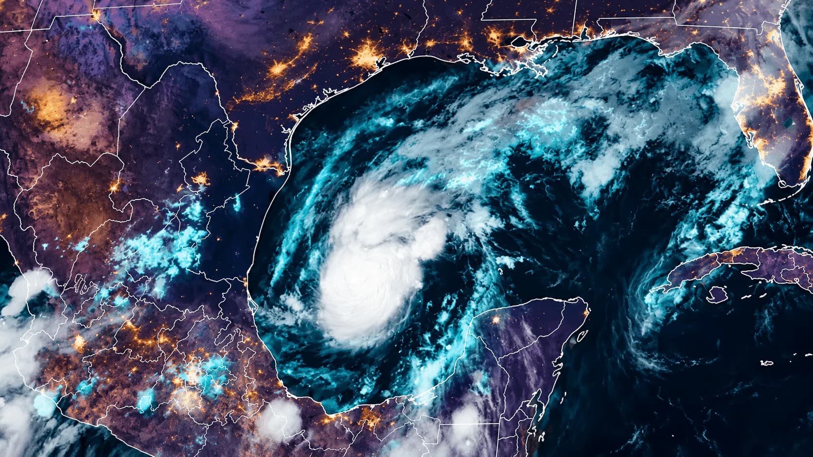
 Linkedin
 Threads
 Facebook
 X
X
Tropical Storm Isaias strengthened early Wednesday morning, with maximum sustained winds of 40 mph while moving east-northeast at about 8 mph.
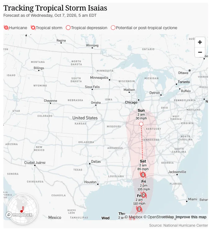
At 4 a.m. CDT, the National Hurricane Center placed the storm roughly 580 miles southwest of the mouth of the Mississippi River and warned that rapid strengthening is expected during the next day or two, with Isaias forecast to become a hurricane by Thursday.
ABC News reports that rain and potentially tropical-storm-force winds could begin reaching the New Orleans-to-Pensacola corridor Friday morning.
The latest NHC marine forecast takes Isaias northward through the central Gulf before bringing it inland near the Alabama–Florida Panhandle region late Friday into early Saturday, although hurricane tracks can still shift substantially this far from landfall.
That means people across southeast Louisiana, coastal Mississippi, southern Alabama and the Florida Panhandle should pay attention now.
For the FPTN network, that includes families around New Orleans, Gulfport, Biloxi, Mobile, Gulf Shores, Orange Beach, Pensacola, Fort Walton Beach and surrounding communities.
FPTN MESSAGE TO OUR GULF COAST COMMUNITY
Do not wait until a hurricane warning is issued to begin preparing.
As of early Wednesday, the National Hurricane Center had not yet issued coastal watches or warnings, but specifically advised people along the northern Gulf Coast to monitor Isaias closely.
Forecasts change. Roads become crowded. Stores empty quickly. And once local officials issue evacuation instructions, preparation time disappears.
Prepare These Things Today
Keep your vehicle fueled and know where you would go if your county orders an evacuation.
Have enough drinking water, nonperishable food, prescription medications and necessary medical supplies for several days. Keep flashlights, batteries, portable chargers, a battery-powered radio and some cash available.
Place identification, insurance information, important documents and emergency phone numbers somewhere waterproof and easy to grab.
Do not forget children, elderly family members and pets. Prepare medications, diapers, pet food, carriers and anything they would need if you suddenly had to leave.
Charge every phone and power bank before conditions deteriorate.
If you live in a mobile home, RV, flood-prone neighborhood or storm-surge zone, identify a safer location now. The American Red Cross warns that mobile and manufactured homes are not safe shelter from hurricane-force winds.
If authorities tell you to evacuate, go. Do not wait to see whether the forecast changes.
And never drive through floodwater.
Where Should You Go?
Shelters are normally opened and announced by county and local emergency-management officials as the threat becomes clearer. Check your county emergency-management office and local government alerts rather than relying on an old shelter address.
The Red Cross also provides updated shelter information through its emergency resources and advises families to have both an evacuation plan and a shelter-in-place plan ready before the storm arrives.
Stay With FPTN
There is no reason for panic this morning.
There is a reason to pay attention.
Isaias is still developing over very warm Gulf waters, its intensity forecast is increasing quickly, and the exact landfall location remains uncertain.
To our FPTN families across the Gulf Coast: prepare early, help your neighbors, check on elderly family members and follow official emergency instructions as they are issued.
FPTN will continue following the storm as the track becomes clearer.